KSZ083
There are no active watches, warnings or advisories
| Mulvane, Kansas, Weather Since May 24, 2004 | |||
|---|---|---|---|
| LAST READING AT TIME: 11:50 AM DATE: June 23 2017, time of next update: 11:55 am | |||
| Current Weather | Dry | Current Temperature | 80.6°F (27.0°C) (Heat Index 80.1°F ), Apparent temp 79.5°F |
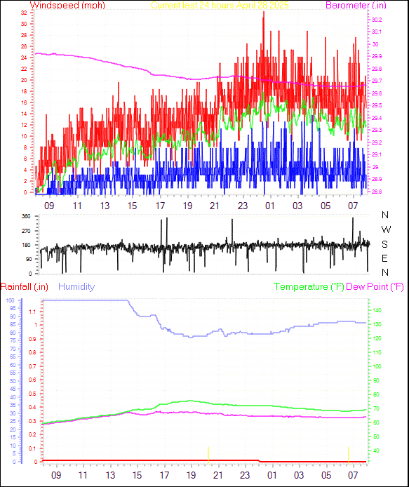
| Maximum Temperature (since midnight) | 81.7°F at: 11:35 AM | Minimum Temperature (since midnight) | 73.2°F at: 5:40 AM |
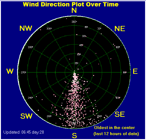
| Average windspeed (ten minute) | 2.9 mph | Wind Direction (ten minute) | E (82°) |
| Heat Index | 80.1°F | Maximum Gust (last hour) | 15.0 mph at: |
| Maximum Gust (since midnight) | 17.5 mph at: 10:45 AM | Maximum 1 minute average (since midnight) | 10.9 mph at: 11:38 AM |
| Rainfall (last hour) | 0.00 in. (0.0 mm) | Rainfall (since midnight) | 0.00 in. (0.0 mm) --- |
| Rainfall This month | 3.66 in. (93.0 mm) | Rainfall To date this year | 19.17 in. (486.9 mm) |
| Maximum rain per minute (last hour) | 0.00 in/min | Maximum rain per hour (last 6 hours) | 0.00 in/hour |
| Yesterdays rainfall | 0.00 in | DewPoint | 51.9°F (Wet Bulb :64.2°F ) |
| Humidity | 37 %, Humidex 83.8°F | Barometer corrected to msl | 29.818 in. (1009.8 hPa) |
| Pressure change | +29.82 in. (last hour) | Trend (last hour) | RISING SLOWLY |
| Pressure change (last 12 hours) | +0.00 in | Pressure change (last 6 hours) | +0.00 in |
Use the RELOAD facility on your browser to retrieve the latest data.